 Fraunhofer Institute for High Frequency Physics and Radar Techniques FHR
Networked HF sensor technology – key technology for FCAS and MGCS
Imaging techniques such as radar are extremely important for the Federal Armed Forces; airborne sensors in particular provide a great deal of information. A radar system which Fraunhofer FHR developed in a German-Swiss collaboration and is continuously optimizing can detect moving targets as well as differences in altitude. The captured data was sent directly to FHR's own ground control station during a test flight.
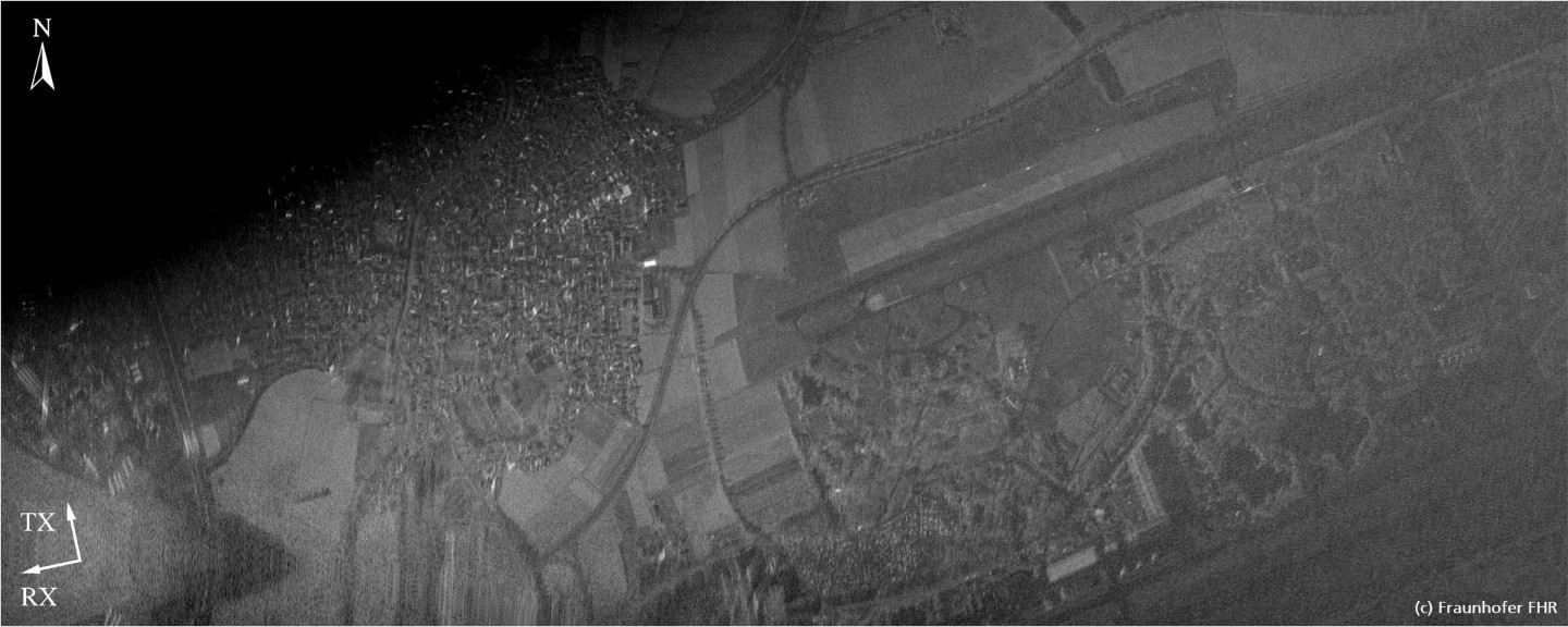
A picture is worth a thousand words? This saying does indeed carry some truth. The Federal Armed Forces appreciates imaging techniques too – especially the good overview from the air. Has anything in the surrounding area changed since the last overflight? Is there anything moving on the ground, for example a tank? In a German-Swiss collaboration, Fraunhofer FHR, the University of Zurich and Armasuisse are working to answer such questions as accurately as possible via radar. Their high-resolution, four-channel SAR (Synthetic Aperture Radar) allows changes to be detected, moving objects identified and even differences in altitude determined.
The system's four receiving antennas are laid out in a cross shape – data is recorded on all four channels at the same time. This allows "along track" information to be obtained, for example to detect moving targets on the ground, while at the same time recording the "cross track" data, from which differences in altitude, for example, can be detected using interferometry. In addition to the radar data, the system records optical camera images, which are also sent to the ground and facilitate the interpretation of the radar images. One of the four receiver channels is also designed for polarimetric operation: The emitted radar waves are linearly polarized in a plane. If they encounter edges, corners and similar man-made objects, their polarization direction can rotate. Valuable conclusions can, in turn, be drawn from this rotation.
Test flights with ultralight aircraft
The German-Swiss collaboration has already existed for over ten years: Fraunhofer FHR develops the hardware (MIRANDA35 radar system) and organizes the test flights, while the University of Zürich handles the evaluation. The developments are financed by Armasuisse. The newly implemented techniques have to pass a practical test once a year: Do they deliver the desired results? The system has now been scaled down so that it can be carried by Fraunhofer FHR's Delphin ultralight aircraft: To do this, all components of the radar system had to be accommodated in a small wingpod under the right wing. Staying within the Delphin's load capacity was a major challenge.
The test flights with the ultralight aircraft, starting from Mönchsheide airfield and flying over Koblenz, the Rhine Valley and the surrounding area, took place from September 21 to 24, 2020. In order to detect moving targets, the Delphin also flew over the Rhine ferry in Königswinter several times. A GPS transmitter on the ferry provided control values. The results are impressive: All components are fully functional and deliver the desired high-resolution SAR images.
Special features: Online SAR and dedicated ground station
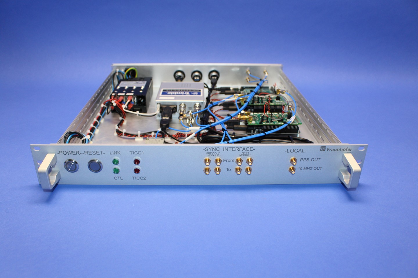
The data is processed on board the Delphin in real time and sent to the ground station as image files. This is because the raw data would be far too large to be send to the ground during the flight. Such online SAR offers a considerable advantage: Operators on the ground receive the images during the overflight and can, for example, immediately signal to the pilot to fly back over an interesting spot. Another special feature: Fraunhofer FHR operates its own ground control station and is thus completely self-sufficient. From there, the radar can be controlled, the flight track managed and monitored, and data within a radius of 40 to 50 kilometers from the aircraft received. Since the station is installed in a van, it is mobile.
In a further development, Fraunhofer FHR is now working on enabling measurement at high altitudes with full bandwidth (high range resolution). The background: The radar system illuminates the ground at a certain angle. If the aircraft climbs a little, the illuminated area expands and the amount of data increases. In the future, the system will be able to deliver high-resolution images even at higher altitudes with the aid of an expansion board.