 Fraunhofer Institute for High Frequency Physics and Radar Techniques FHR
More informative images of space objects and improved estimates of the state of drifting debris: this is the goal of a Fraunhofer FHR research study. The space surveillance radar TIRA (Tracking and Imaging Radar) is being expanded from a monostatic system to an experimental multistatic network.


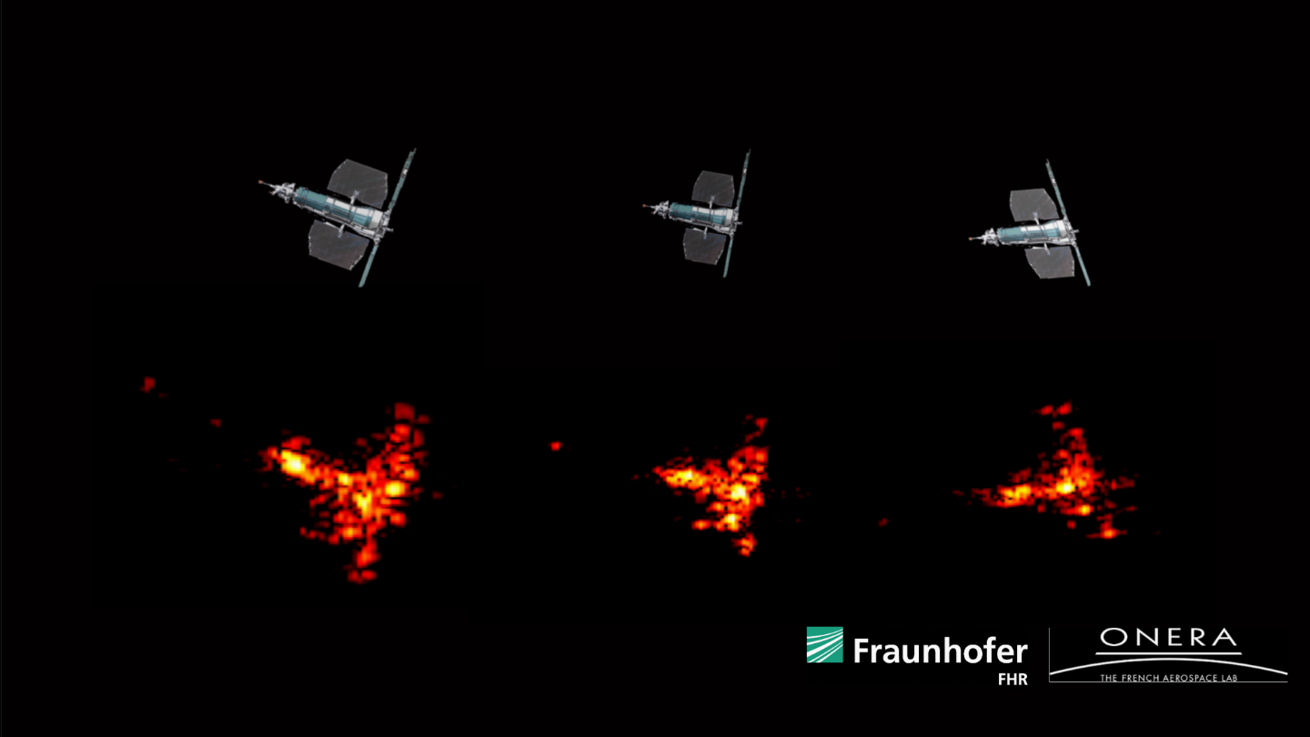
As a partner to space agencies, satellite operators, and security and defense authorities with space relevance, TIRA provides, among other things, high-resolution radar images and analyses of space objects. By expanding to a multistatic network with spatially separated receiving locations, these data are expected to become even more precise. The researchers anticipate that the long baselines resulting from this will yield different image projections, making previously concealed or ambiguous structures of the objects visible. New line-based evaluation methods enable an improved estimate of 3D shape, spin, and position of non-cooperative objects such as space debris.
Spatially separated receiving locations improve ISAR imaging
Within the framework of the WTD 81-funded study “TIRA Multistatic,” Fraunhofer FHR researchers investigate and demonstrate multistatic radar imaging in the inverse Synthetic Aperture Radar (ISAR) method with large baselines. The study is conducted in cooperation with the French research company ONERA. Specifically, TIRA transmits high-bandwidth signals in the Ku‑band (and L‑band for tracking) into orbit, while remote stations in the radar network receive the echoes. The first station is ONERA’s PRISME; additional receiving antennas could follow. The resulting long baselines lead to different lines of sight and thus to different projection surfaces of the ISAR images. This offers the following advantages:
- Increased observation diversity
- Improved geometric informativeness
- Enhanced interpretability of bistatic images
New measurement and evaluation chains for a multistatic radar imaging network
The spatial diversity over large distances in multistatic radar networks imposes high requirements for synchronization, orbit tracking, geolocation of receiving stations, calibration, and data fusion. The study partners are developing tailored measurement and evaluation chains. These include joint campaigns regarding target selection, illumination geometries, and scheduling. Hardware integration of the receivers into the TIRA system is also planned. New signal processing procedures are being developed for the consistent reconstruction of mono- and bistatic ISAR images as well.
Line-based estimation method analyzes space objects in more detail
For estimating the dimensions, spin, and position of non-cooperative targets such as space debris, a line-based method is being developed. This is applied to realistic scenarios: In mono- and bistatic ISAR images, identified structural lines such as edges of solar panels or antenna masts serve as the basis. Using least-squares optimization, then the spin axis, angular velocity, and the 3D coordinates of notable object features are determined. The method uses range- and cross-range projections at multiple time points and checks the consistency of the calculated projections with the measured ISAR images. Thus, from a sequence of mono- and bistatic images, a coherent 3D shape and motion description can be derived.
Multistatic measurements reduce motion ambiguities
Simulations and measurement data show that multistatic measurements significantly reduce motion ambiguities. Scenarios in which monostatic data allow several plausible rotation solutions become more robust and often unambiguous due to the additional bistatic geometry. Moreover, multistatic imaging enables improved validation of simulation models, as rotation states can be cross-checked from multiple viewpoints simultaneously. Thus, multistatic ISAR provides a substantial contribution to building future radar imaging networks that deliver more comprehensive information for mission support, damage analysis, fragmentation assessment, reentry monitoring, or identification of unknown objects in the space domain. TIRA-Multistatic demonstrates technical feasibility and analytical added value and thus lays the groundwork for broader use of multistatic radar networks in civilian and security-relevant space situational awareness.