 Fraunhofer Institute for High Frequency Physics and Radar Techniques FHR
If you want to map terrain from an aircraft using radar with as high a resolution as possible, the best approach is to fly in circles above it. Fraunhofer FHR has developed a corresponding circular Synthetic Aperture Radar — circular SAR for short. It operates at 94 GHz, achieving very high resolution. It can also deliver single-channel 3D mappings and reliably detect moving objects.
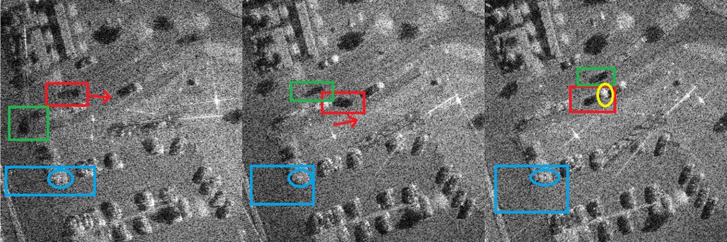
You know it from driving: when you pass an object, you only get a relatively fleeting glimpse. If you circle around the object, you can view it from all sides. The same applies to radar imaging. Typically, SAR is flown with an aircraft in a straight line over the object and radar data are collected during that pass. With circular SAR, the aircraft flies circular orbits over the area to be observed. While this makes signal processing more challenging, it provides a significantly expanded data base because a given area can be illuminated over a long period — and as with radar, independent of time of day and weather.
Significantly higher possible resolution
This longer data collection is reflected in the resolution of the image: while lateral resolution in linear SAR is physically limited by the antenna aperture and typically a few centimeters, circular SAR can theoretically achieve resolutions down to the order of a few millimeters. The key advantage is the complete circumferential surveying of the target area, allowing objects to be captured from many viewing angles and the signals to be coherently combined. Occlusions caused by buildings or vegetation are also reduced. In addition to high resolution, circular SAR also enables three-dimensional imaging with a single-channel system. This is particularly interesting for practical applications where data throughput should be kept low and the measurement should be as simple as possible.
Unique feature: 94 gigahertz
The frequency of Fraunhofer FHR’s circular SAR is 94 GHz — a unique selling point, because other circular SAR systems operate at substantially lower frequencies. The advantage of the higher frequency is that the wavelength of the signals is smaller, illumination times can be shorter, and finer resolutions are possible. The practically achieved resolution is currently about two centimeters. This makes the system especially suited for applications where small-scale structural details are relevant.
Another feature of Fraunhofer FHR’s circular SAR: regardless of how the aircraft moves, the radar system keeps the same ground point in view. This is made possible by a gimbal whose control software has been specifically adapted. Instead of merely compensating for motion, the gimbal now focuses on fixed GPS coordinates. This ensures a constant observation geometry and forms the basis for comparable and reproducible measurements, even over longer time periods.
Imaging moving targets
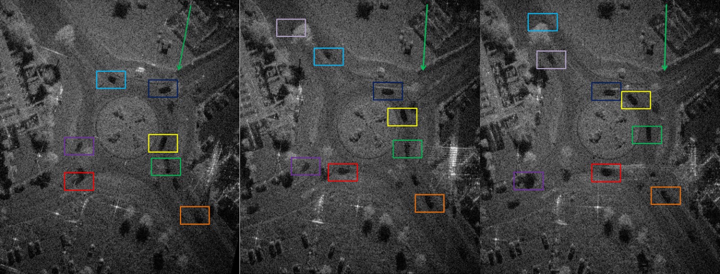
There are further features: circular SAR allows not only static objects to be mapped but, for the first time, moving targets to be analyzed in detail. This was demonstrated in a test series in which a roundabout was mapped with circular SAR. If cars drove through the roundabout, they would appear blurred in single-channel linear SAR. The shape of moving objects would only be sharply imaged if all three velocity components of the objects were known — which is usually not the case. In circular SAR, the moving shadows of objects are visible, as well as their concrete shape. Trucks, small cars, and people can be well differentiated in this way.
Height information through variable focus planes
Height information can also be provided by the single-channel measurement. Different focus levels can be set: for example, focusing on street level allows manhole covers, cars, etc. to be identified. Focusing on the height of building roofs makes the street appear blurred, but the roofs are well imaged. This flexible focusing broadens the range of use, especially in urban and infrastructure-complex environments.
A prototype of the circular SAR system already exists. Building on this, a two-channel circular SAR system is to be developed. Then interferometric measurements will also be possible — from which the height of objects can be determined directly. This development opens up additional perspectives for cooperative research projects as well as application-oriented projects with partners from authorities and industry.